Environmental Assessment
Project Value: $4 Million
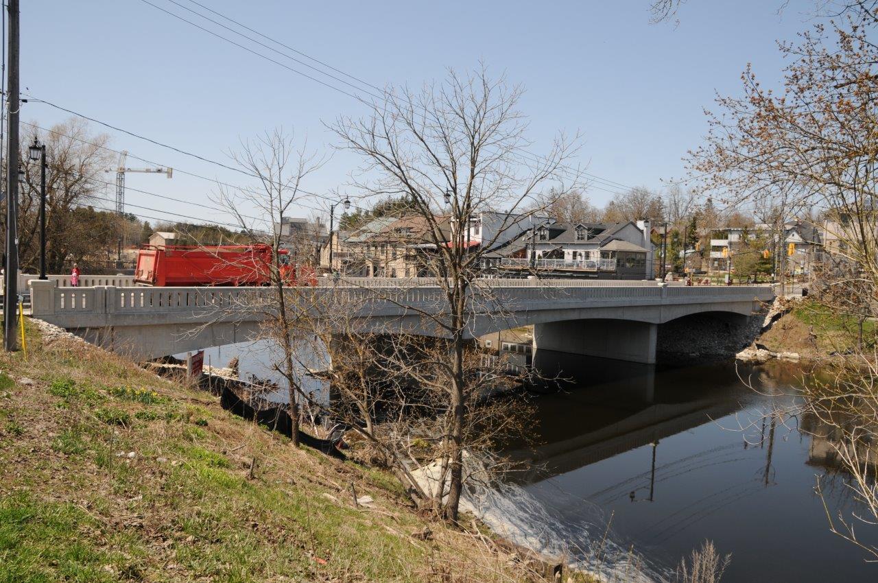
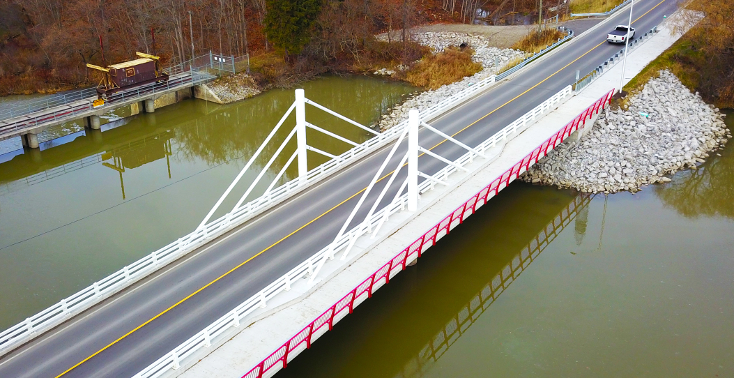
BTE completed a Schedule C Class Environmental Assessment and Preliminary Design for the replacement of the historic Badley (Metcalfe Street) Bridge over the Grand River. The design has included a separate Value Engineering/Constructability review involving contractors. The detail design has involved securing permits and approvals from DFO (for infilling of the river for temporary support of falsework), Transport Canada, Grand River Conservation Authority and MOECC. The new bridge will be a 3 span rigid frame structure.
Project Value: $8 Million
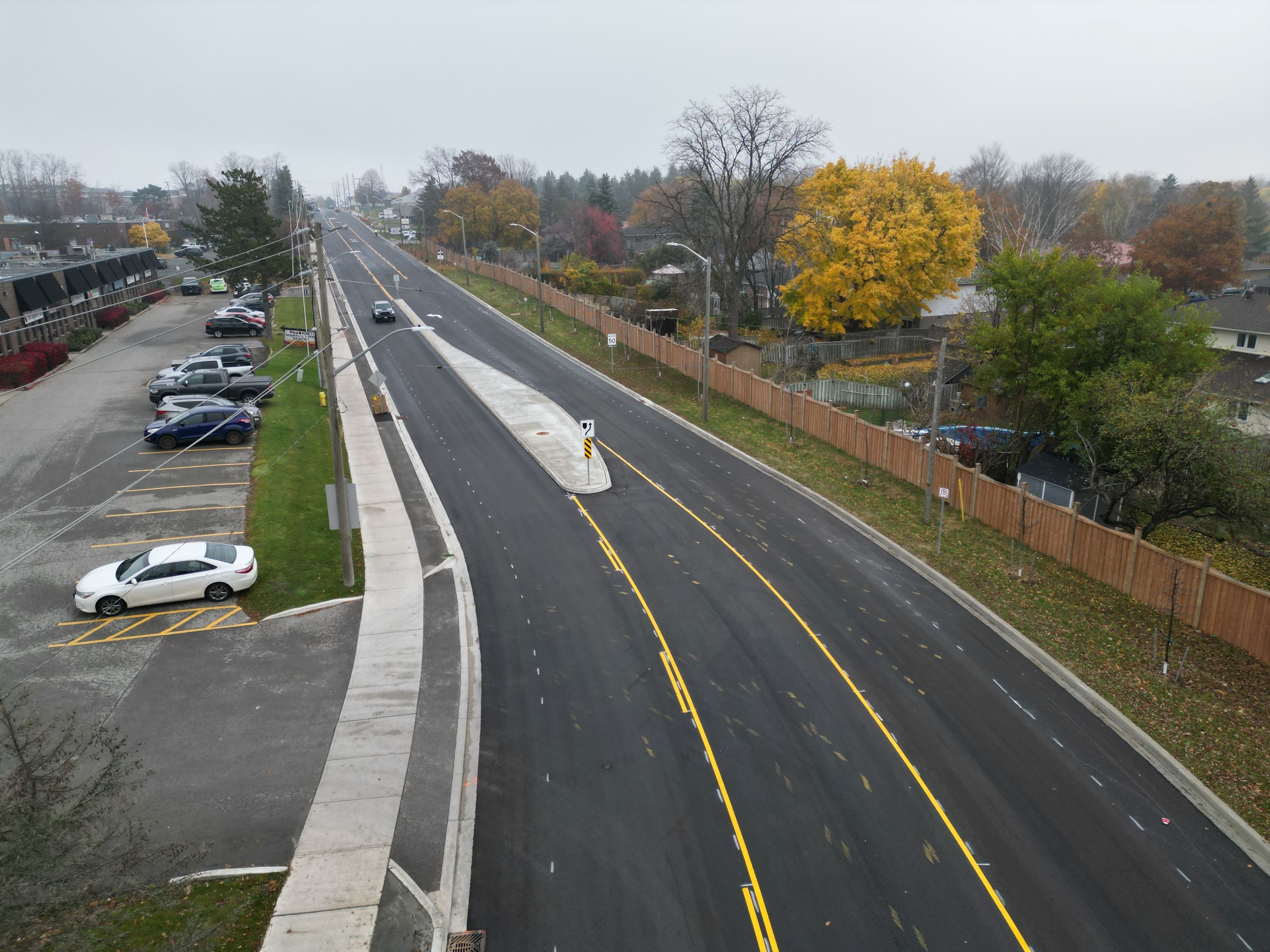
The City of Barrie initiated two Class Environmental Assessments (EA) in the downtown and BTE completed the two Class EAs under one assignment. The first EA was for the widening of Bell Farm Road (a major collector road) with improvements for pedestrians and cyclists. The work included investigation and evaluation of intersection configurations and roadway cross section improvements for both vehicular and active transportation. The project recommendations included: buffer bicycle lanes, sidewalks, continuous two-way left-turn lane, low impact development (LID) stormwater infiltration pond, utility relocations, lighting, pedestrian crossover, landscaping, low height retaining structures and visual screening (fencing along residential frontage). The land use surrounding Bell Farm Road is a mix of residential, commercial and industrial. All environmental and regulatory agency approvals were obtained and construction was initiated in 2020. Construction was completed in the fall of 2022.
The second EA was for the proposed widening and realignment of Ross Street (downtown arterial roadway) with improvements for pedestrians and cyclists as well as intersection improvements for the intersection of Ross Street, Collier Street and Bayfield Street.
Project Value: $18 Million (tendered), $1 Million (engineering fees)
BTE was the prime consultant and completed the EA, Detail Design and CA.
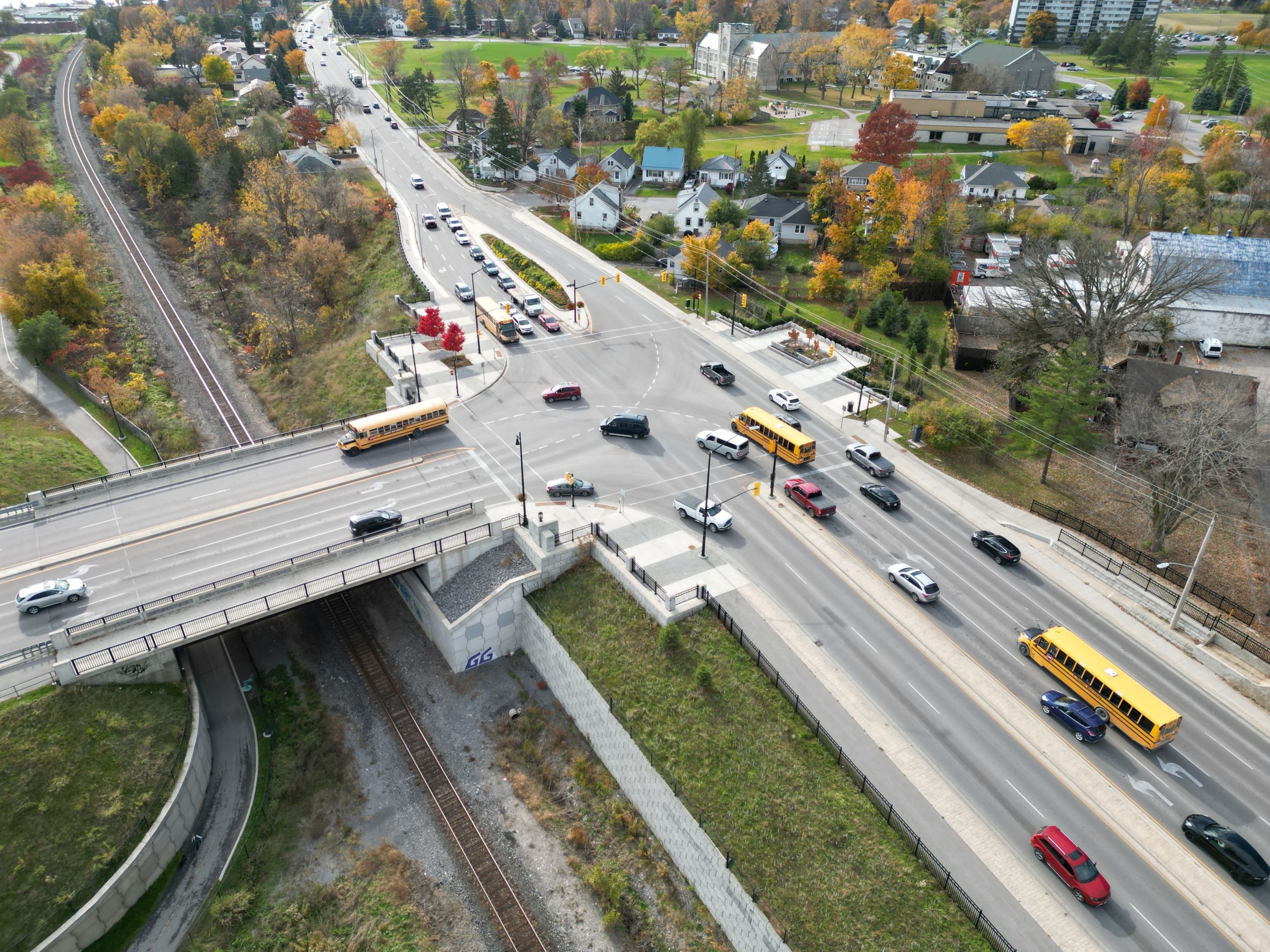
BTE led this Schedule C Municipal Class Environmental Assessment, preliminary design and detail design for a major urban arterial reconstruction project. This assignment delivered an $18 million urban renewal project including: replacement of the Bay Bridge Road CP Rail bridge, realignment and reconstruction of 150 m of Bay Bridge Road (4 lane arterial), realignment and reconstruction of 100 m of Old Bay Bridge Road (2-lane Collector), and reconstruction and widening of 1 km of Dundas Street West (widening to a 5-lane arterial) with the introduction of a widened and relocated intersection of Dundas Street West (former Highway 2) and Bay Bridge Road (former Highway 62). The designs were completed following the TAC – Geometric Design Guide for Canadian Roads. This project constructed a prominent southern entry to the downtown core of Belleville.
The project included complex elements such as: roadway designs (Dundas Street West widening to a 5-lane cross section and Bay Bridge Road to 4 lanes; Old Bay Bridge Road realignment (2 lanes); major new intersection with dual left-turn lanes; subsurface domestic waste consolidation and isolation of contaminants from release (MECP approvals); environmental monitoring and reporting to MECP; and water quality concerns from Quinte Region Conservation Authority for fill placement and roadway widening; property buyouts (2 houses removed within the new signalized intersection); new watermain; multi-use trail, streetscaping and gateway treatments; and approval by CP rail for a new grade separation agreement and occupation permit for the recreational trail. Mr. Taylor led the negotiations for MECP endorsement of a design approach for a new roadway embankment over a former landfill site (considering excavation and displacement approaches for the new 4-lane alignment over the landfill rather than removal of the waste – saving an estimated $1 million).
This Class Environmental Assessment and Detail Design assignment was for the planning and design of active transportation facilities on Beverly Street from Dundas Street North to Elgin Street North. Beverly Street currently operates as a 2-lane arterial road constrained by the historic CP Rail subway that operates as a courtesy crossing.
The EA study defined a roadway improvement plan to safely accommodate vehicular, pedestrian and cyclist travel along Beverly Street. The Recommended Plan included a three phased approach including: construction of a sidewalk on the east side of the corridor (through the existing subway) in the short-term; construction of a multi-use trail behind the existing south abutment to separate vehicular and active transportation in the medium term; and construction of a single lane bridge east of the existing structure to allow 2-way flow and accommodate space for all modes.
Following completion of the EA, BTE proceeded to detail design which included design of road reconstruction, municipal services and a new pedestrian underpass. This involved consultation with the Region of Waterloo and CP Rail.
Project Value: $25 Million (construction)
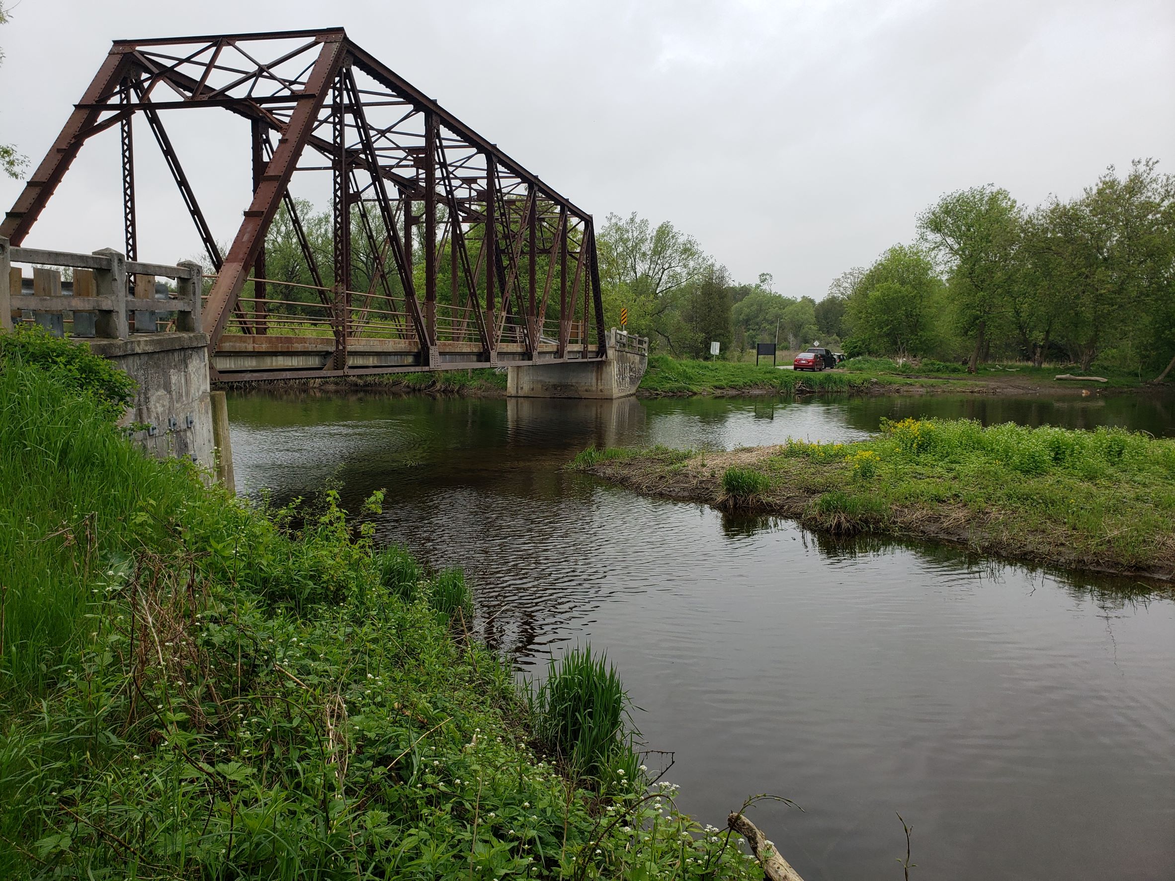
The Black Bridge is a single lane historic bridge over the Speed River in Cambridge. The current traffic exceeds the capacity of the bridge and the restricted capacity limits the usefulness of the crossing. The bridge is considered to be of significant heritage value.
The project included a 4 year schedule to define a context sensitive community design solution for the asset management of a heritage truss structure over the Speed River. The project included proactive community consultation including the use of a Study Design and Neighbourhood Café event to solicit early community involvement, and a Value Planning workshop to engage agencies. The study has completed comprehensive environmental inventories of the natural, social and cultural environment including: archaeological, fisheries, Phase 1 ESA, noise analysis, and cultural heritage assessments. Technical studies have included traffic origin-destination study, geotechnical, hydrology and hydraulics, river fluvial geomorphological and sediment transport, structural evaluations and emergency inspections from vehicle collisions, structural preliminary GA’s and landscape architectural rendering of alternatives. The final design has developed a long span bridge (140 m) to cross both the river and PSW and provide a lookout to the Heritage designated structure which will become part of a MUP. It also included the planning of Black Bridge Road (1 km) and Townline Road (1.5 km). The complexity of the project grew to include First Nations, Regional Heritage and the GRCA interests. The study area and roads under study involved the City, Puslinch Township, Wellington County and the Region of Waterloo. The Project met the requirements of a Schedule C Class EA including extensive public consultation for a contentious project that straddles multiple municipalities and jurisdictions of approval. BTE managed the EA and roadway design elements of the project and Brown|CO developed structural alternatives for the crossing as part of the BTE team for the Environmental Assessment.
Looking to get in touch with our team?
BTE offers services in transportation planning, design, and construction in both the public and private sectors, using our hands-on approach that stands out in today’s consulting profession.


